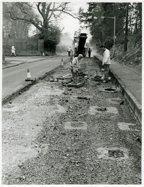
The Museum’s photography collection includes many images of historic buildings and structures. In this 1993 photograph, resurfacing work on the Andover Road has revealed a World War Two roadblock made of concrete bases that contained timber posts. An important ‘stop line’ against potential German invasion ran east to west along the Kennet Valley, with pillboxes, anti-tank ditches and other obstructions to halt enemy forces. Newbury’s position as a crossroads for the south would also have needed defending.
There has been a growing interest in 20th century military archaeology.
Further information about the archaeological site is available on the HER: www.heritagegateway.org.uk/Gateway/Results_Single.aspx?uid=MWB20209&resourceID=1030
HER – The Historic Environment Record (HER) is a register of all known archaeological and historical sites in the unitary authority of West Berkshire.
Period: 1900-2000
Place: Newbury


