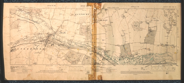
A printed and annotated Ordnance Survey Map of the Kennet Valley hand coloured by local archaeologist Roy Froom to clearly depict rivers and geological features such as gravel pits and chalk pits, the likely route of the Roman road and other archaeological features. Roy Froom was a member of the St Bartholomew School Archaeology Group and later became an important amateur archaeologist in and around Newbury and wrote The Mesolithic of the Kennet Valley.” This item was considered to be part of the Roy Froom archaeological archive in that it represented his youthful exploration of the Kennet Valley.
Period: Mid 20th century
Place: Kennet Valley